2012
SY9682 : Ordnance Survey Flush Bracket (10422)
taken 12 years ago, near to Corfe Castle, Dorset, England
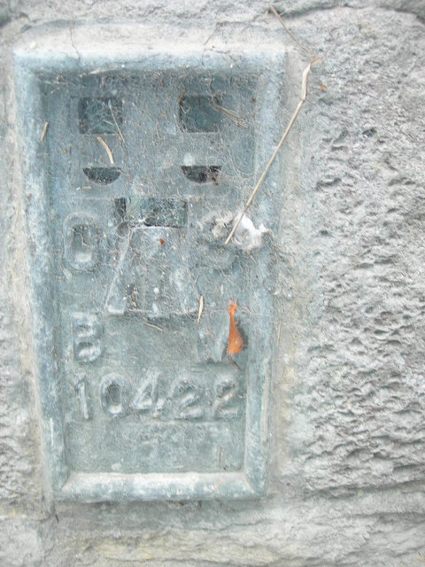
Ordnance Survey Flush Bracket (10422)
This OS Flush Bracket 10422 can be found on the wall of the pumping station. It marks a point 13.474m above mean sea level.
 Map © Crown Copyright")
TIP: Click the map for more Large scale mapping
- Grid Square
- SY9682, 738 images (more nearby 🔍)
- Photographer
- Adrian Dust (more nearby)
- Date Taken
- Sunday, 23 September, 2012 (more nearby)
- Submitted
- Saturday, 5 October, 2013
- Subject Location
-
OSGB36:
 SY 9608 8249 [10m precision]
WGS84: 50:38.5251N 2:3.4080W - Camera Location
-
OSGB36: SY 9608 8249
- View Direction
- Southeast (about 135 degrees)