2004
SZ5485 : Site of former Horringford station
taken 20 years ago, near to Arreton, Isle of Wight, England
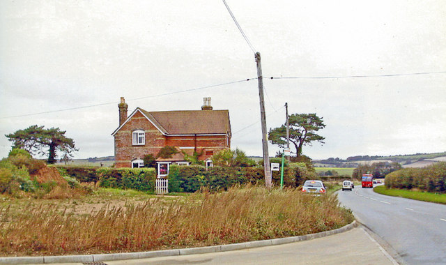
Site of former Horringford station
View northward on A3056, where there was a level-crossing with the ex-Isle of Wight Central Railway branch from Merstone (to left) to Sandown (to right). The station and line were closed 6/2/56.
 Map © Crown Copyright")
TIP: Click the map for more Large scale mapping
- Grid Square
- SZ5485, 26 images (more nearby 🔍)
- Photographer
- Ben Brooksbank (more nearby)
- Date Taken
- Thursday, 23 September, 2004 (more nearby)
- Submitted
- Thursday, 10 October, 2013
- Subject Location
-
OSGB36:
 SZ 543 853 [100m precision]
WGS84: 50:39.9285N 1:13.9747W - Camera Location
-
OSGB36: SZ 543 853
- View Direction
- North-northwest (about 337 degrees)