J3274 : Belfast - Shankill Road - Protestant area
taken 11 years ago, near to Belfast, Co Antrim, Northern Ireland
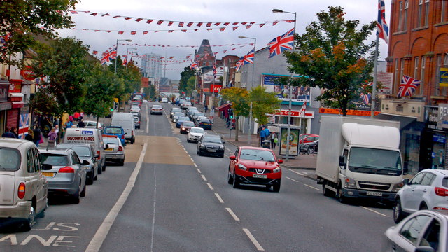
Belfast - Shankill Road - Protestant area
It appears that St Anne's Cathedral can be seen in the distance.
![Creative Commons Licence [Some Rights Reserved]](https://s1.geograph.org.uk/img/somerights20.gif)
|
· Find out How to reuse this image ·
Share:
|
|||||
|
There are 2 posts in a
discussion on J3274 (preview on the left) |
Suggest an update to this image | Contact the contributor | |||
Loading map... (JavaScript required)
- Grid Square
- J3274, 289 images (more nearby
 )
)
- Photographer
- Joseph Mischyshyn (find more nearby)
- Date Taken
- Monday, 23 September, 2013 (more nearby)
- Submitted
- Monday, 14 October, 2013
- Geographical Context
- Subject Location
-
Irish:
 J 329 748 [100m precision]
WGS84: 54:36.2463N 5:56.5916W - Camera Location
-
Irish: J 325 747
- View Direction
- EAST (about 90 degrees)
Image classification(about):
Geograph
This page has been viewed about 416 times.
View this location:
KML (Google Earth) ·
Google Maps ·
Bing Maps ·
Geograph Coverage Map ·
More Links for this image
·
Bing Maps ·
Geograph Coverage Map ·
More Links for this image