2010
SJ4663 : Bench mark on St Peter's church tower, Waverton
taken 14 years ago, near to Waverton, Cheshire West And Chester, England
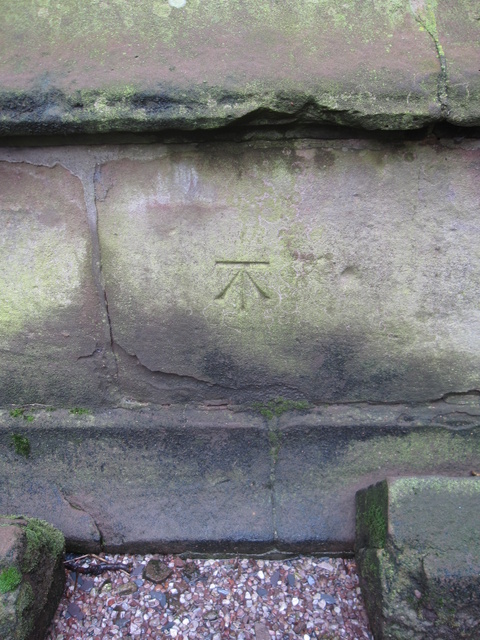
Bench mark on St Peter's church tower, Waverton
This Ordnance Survey bench mark is on the north face of the church tower. It is recorded on the 1899 O.S. map.
 Map © Crown Copyright")
TIP: Click the map for more Large scale mapping
- Grid Square
- SJ4663, 26 images (more nearby 🔍)
- Photographer
- John S Turner (more nearby)
- Date Taken
- Thursday, 23 September, 2010 (more nearby)
- Submitted
- Tuesday, 21 January, 2014
- Subject Location
-
OSGB36:
 SJ 4616 6335 [10m precision]
WGS84: 53:9.8720N 2:48.4059W - Camera Location
-
OSGB36: SJ 4616 6335
- View Direction
- South-southeast (about 157 degrees)