J3373 : Former "Gilpin's", Sandy Row, Belfast
taken 10 years ago, near to Belfast, Co Antrim, Northern Ireland
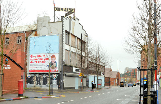
A long-term derelict former furniture shop, in Sandy Row, with no immediate proposals for redevelopment.
There is a lengthy draft Belfast City Council feasibility study (undated in the web version available on 11 August 2019) which concludes The project is complex. As an initial step the building needs to be transferred from the private sector to an appropriate entity, possibly the Council, and appropriate grant funding secured. Given the mix of uses it is likely that this entity will act as a landlord, providing space to a range of occupiers who will then be responsible for delivery. Individual agreements, linked to the underlying business model of each use, will be needed. The potential to incorporate the current community centre in the overall vision is noted, expanding both the area and scope of intervention. This approach would need to be dealt with in a parallel process because the community centre is currently a BCC asset. The internal capital process of extending and developing the community centre is different to the proposed acquisition and development of the Gilpins building even though they are inextricably linked. It should be noted as a challenge at this stage.
![Creative Commons Licence [Some Rights Reserved]](https://s1.geograph.org.uk/img/somerights20.gif)
|
· Find out How to reuse this image ·
Share:
|
|||||
|
There are 2 posts in a
discussion on J3373 (preview on the left) |
Suggest an update to this image | Contact the contributor | |||
- Grid Square
- J3373, 2776 images (more nearby
 )
)
- Photographer
- Albert Bridge (find more nearby)
- Date Taken
- Sunday, 9 March, 2014 (more nearby)
- Submitted
- Sunday, 9 March, 2014
- Geographical Context
- Place (from Tags)
- Subject Location
-
Irish:
 J 334 734 [100m precision]
WGS84: 54:35.4852N 5:56.2215W - Camera Location
-
Irish: J 334 733
- View Direction
- NORTH (about 0 degrees)
Other Tags