D0605 : Train, Cullybackey - April 2014(2)
taken 10 years ago, near to Cullybackey, Co Antrim, Northern Ireland
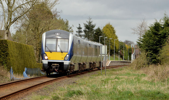
The railway between Ballymena and Ballymoney opened in 1855. Cullybackey station and level crossing opened and closed in 1856 before re-opening in 1865. It closed again in 1976 before re-opening in 1982. Once a block post with two platforms, a passing loop, signal cabin and goods yard, only the former down platform remains in use. There is a level crossing, across the Station Road, at the Ballymoney end.
Broughdone level crossing is approximately one mile to the north. Cullybackey North (originally Cullybackey no2) level crossing, across the Old Cullybackey Road, is approximately ¼ mile to the south of the station.
Cullybackey South (originally Cullybackey no1) level crossing, across the Ballymena Road, is approximately ½ mile to the south of the station.
All crossings are automatic half barriers remotely monitored.
![Creative Commons Licence [Some Rights Reserved]](https://s1.geograph.org.uk/img/somerights20.gif)
|
· Find out How to reuse this image ·
Share:
|
|||||
| Start a discussion on D0605 | Suggest an update to this image | Contact the contributor | |||
- Grid Square
- D0605, 26 images (more nearby
 )
)
- Photographer
- Albert Bridge (find more nearby)
- Date Taken
- Friday, 11 April, 2014 (more nearby)
- Submitted
- Friday, 11 April, 2014
- Geographical Context
- Place (from Tags)
- Railway (from Tags)
- Subject Location
-
Irish:
 D 063 055 [100m precision]
WGS84: 54:53.1903N 6:20.5934W - Camera Location
-
Irish: D 064 054
- View Direction
- Northwest (about 315 degrees)
Other Tags