S0211 : North of the Knockmealdowns - County Tipperary
taken 28 years ago, 3 km from Clogheen, Co Tipperary, Ireland
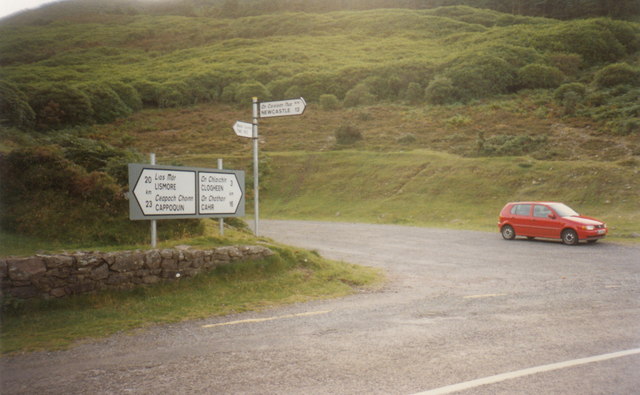
North of the Knockmealdowns - County Tipperary
The road through the Knockmealdown Mountains from Cappoquin to Clogheen parallels for a while the East Munster Way. This route of 70 kilometres runs from Carrick-on-Suir to Clogheen via Clonmel and forms part of European Walking Route E8, from Dursey Island, County Cork to Istanbul, Turkey. Time photo taken not available.
S0211 : From the Knockmealdowns - County Tipperary S0211 : North to the Galtys - County Tipperary
S0211 : From the Knockmealdowns - County Tipperary S0211 : North to the Galtys - County Tipperary
![Creative Commons Licence [Some Rights Reserved]](https://s1.geograph.org.uk/img/somerights20.gif)
|
· Find out How to reuse this image ·
Share:
|
|||||
| Start a discussion on S0211 | Suggest an update to this image | Contact the contributor | |||
Loading map... (JavaScript required)
- Grid Square
- S0211, 8 images (more nearby
 )
)
- Photographer
- Martin Richard Phelan (find more nearby)
- Date Taken
- September 1996 (more nearby)
- Submitted
- Sunday, 20 April, 2014
- Geographical Context
- Place (from Tags)
- Primary Subject of Photo
- Subject Location
-
Irish:
 S 027 113 [100m precision]
WGS84: 52:15.2386N 7:57.6627W - Camera Location
-
Irish: S 027 113
- View Direction
- South-southwest (about 202 degrees)
Other Tags
This page has been viewed about 103 times.
View this location:
KML (Google Earth) ·
Google Maps ·
Bing Maps ·
Geograph Coverage Map ·
More Links for this image
·
Bing Maps ·
Geograph Coverage Map ·
More Links for this image