S0211 : North to the Galtys - County Tipperary
taken 28 years ago, 3 km from Clogheen, Co Tipperary, Ireland
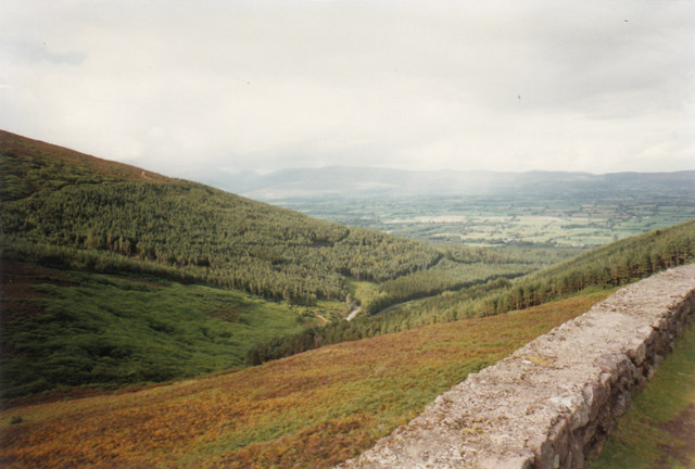
North to the Galtys - County Tipperary
Taken from a parking place near The Vee on the R668 from Cappoquin to Clogheen, this view from the foot of Sugarloaf Hill in the Knockmealdown Mountains extends north over this vale in County Tipperary between Clogheen and Ardfinnan. On the horizon are the Galty Mountains. Time taken not available.
S0210 : Bay Lough - Glenlough, County Tipperary S0310 : South to County Waterford - County Tipperary
S0210 : Bay Lough - Glenlough, County Tipperary S0310 : South to County Waterford - County Tipperary
![Creative Commons Licence [Some Rights Reserved]](https://s1.geograph.org.uk/img/somerights20.gif)
|
· Find out How to reuse this image ·
Share:
|
|||||
| Start a discussion on S0211 | Suggest an update to this image | Contact the contributor | |||
Loading map... (JavaScript required)
- Grid Square
- S0211, 8 images (more nearby
 )
)
- Photographer
- Martin Richard Phelan (find more nearby)
- Date Taken
- September 1996 (more nearby)
- Submitted
- Monday, 21 April, 2014
- Geographical Context
- Place (from Tags)
- Primary Subject of Photo
- Subject Location
-
Irish:
 S 027 116 [100m precision]
WGS84: 52:15.4220N 7:57.6450W - Camera Location
-
Irish: S 031 107
- View Direction
- North-northwest (about 337 degrees)
Other Tags
Image classification(about):
Supplemental image
This page has been viewed about 186 times.
View this location:
KML (Google Earth) ·
Google Maps ·
Bing Maps ·
Geograph Coverage Map ·
More Links for this image
·
Bing Maps ·
Geograph Coverage Map ·
More Links for this image