S0210 : Bay Lough - Glenlough, County Tipperary
taken 28 years ago, 4 km SE of Clogheen, Co Tipperary, Ireland
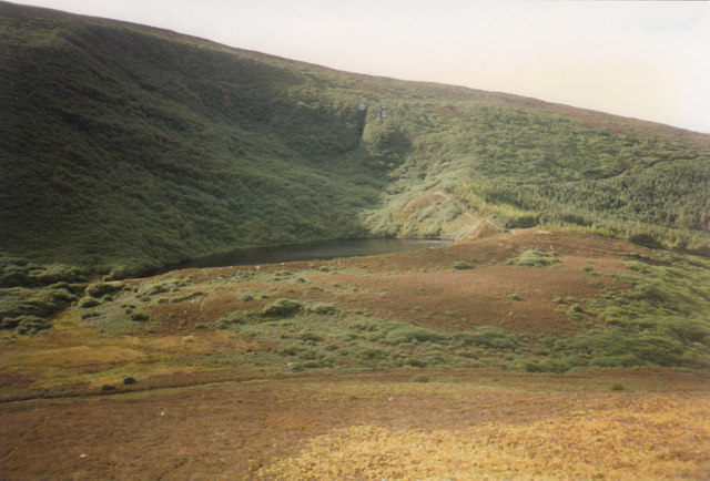
Bay Lough - Glenlough, County Tipperary
Sitting north north west of the head of Glenlough, Bay Lough lies at the northern foot of the Knockmealdown Mountains. This view is from a parking place at the foot of Sugarloaf Hill, on the R668 road from Cappoquin to Clogheen. Time taken not available.
S0211 : North to the Galtys - County Tipperary S0310 : South to County Waterford - County Tipperary
S0211 : North to the Galtys - County Tipperary S0310 : South to County Waterford - County Tipperary
![Creative Commons Licence [Some Rights Reserved]](https://s1.geograph.org.uk/img/somerights20.gif)
|
· Find out How to reuse this image ·
Share:
|
|||||
| Start a discussion on S0210 | Suggest an update to this image | Contact the contributor | |||
Loading map... (JavaScript required)
- Grid Square
- S0210, 6 images (more nearby
 )
)
- Photographer
- Martin Richard Phelan (find more nearby)
- Date Taken
- September 1996 (more nearby)
- Submitted
- Monday, 21 April, 2014
- Geographical Context
- Place (from Tags)
- Primary Subject of Photo
- Subject Location
-
Irish:
 S 026 108 [100m precision]
WGS84: 52:15.0068N 7:57.7069W - Camera Location
-
Irish: S 031 107
- View Direction
- West-northwest (about 292 degrees)
Other Tags
Image classification(about):
Supplemental image
This page has been viewed about 146 times.
View this location:
KML (Google Earth) ·
Google Maps ·
Bing Maps ·
Geograph Coverage Map ·
More Links for this image
·
Bing Maps ·
Geograph Coverage Map ·
More Links for this image