2005
SN6787 : Pen-dinas hillfort, Mynydd Gorddu
taken 19 years ago, near to Bont-Goch or Elerch, Ceredigion/Sir Ceredigion, Wales
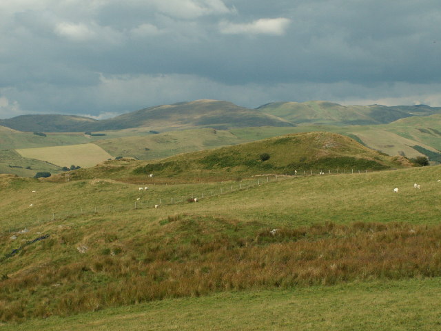
Pen-dinas hillfort, Mynydd Gorddu
Iron Age hillfort NE of the Mynydd Gorddu windfarm, with surrounding sheep pasture.
 Map © Crown Copyright")
TIP: Click the map for more Large scale mapping
- Grid Square
- SN6787, 2 images (more nearby 🔍)
- Photographer
- Nigel Callaghan (more nearby)
- Date Taken
- Tuesday, 16 August, 2005 (more nearby)
- Submitted
- Friday, 19 August, 2005
- Subject Location
-
OSGB36:
 SN 67 87 [1000m precision]
WGS84: 52:28.1586N 3:57.1197W