G5988 : Lough-Dhoire-Thoirc
taken 10 years ago, 5 km NNW of Meenaneary, Co Donegal, Ireland
Lough-Dhoire-Thoirc
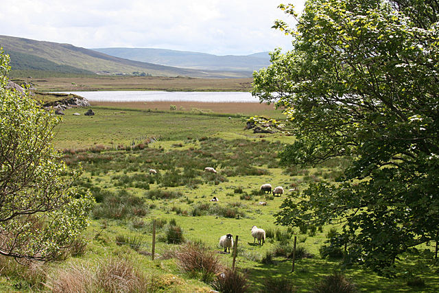
Anglicised as Loch Eraherk, this small loch is almost certainly shrking by the decade if not by the year. Vegetation is encroaching around its perimeter, and the extensive area of flat land around it indicates how much larger it once was.
![Creative Commons Licence [Some Rights Reserved]](https://s1.geograph.org.uk/img/somerights20.gif)
|
· Find out How to reuse this image ·
Share:
|
|||||
| Start a discussion on G5988 | Suggest an update to this image | Contact the contributor | |||
Loading map... (JavaScript required)
- Grid Square
- G5988, 9 images (more nearby
 )
)
- Photographer
- Anne Burgess (find more nearby)
- Date Taken
- Wednesday, 21 May, 2014 (more nearby)
- Submitted
- Thursday, 5 June, 2014
- Geographical Context
- Subject Location
-
Irish:
 G 593 885 [100m precision]
WGS84: 54:44.5966N 8:37.9060W - Camera Location
-
Irish: G 591 887
- View Direction
- Southeast (about 135 degrees)
Image classification(about):
Geograph
This page has been viewed about 63 times.
View this location:
KML (Google Earth) ·
Google Maps ·
Bing Maps ·
Geograph Coverage Map ·
More Links for this image
·
Bing Maps ·
Geograph Coverage Map ·
More Links for this image