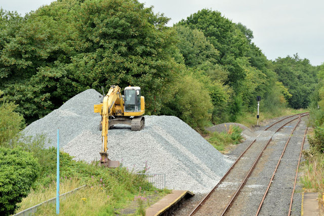
J1667 : Ballast, Ballinderry station (July 2014)
taken 10 years ago, 5 km NNW of Maghaberry, Co Antrim, Northern Ireland
The line between Knockmore Jct and Antrim opened in 1871 with intermediate stations, halts and calling places at Brookmount, Brookhill. Meeting House, Ballinderry, Legatiriff, Glenavy, Crumlin, Aldergrove and Millars Bridge. It closed to passengers in 1960 but remained open for cross-Border freight trains to/from Londonderry. A local passenger service, from Lisburn to Antrim serving Ballinderry, Glenavy and Crumlin, was restored in 1974. The signal cabin and junction at Knockmore Jct closed in 1977 with the opening of a third line to Lisburn which included a Knockmore halt at the Ballinderry Road, Lisburn.
Belfast Londonderry/Portrush trains were diverted to the line in 1978 and used it until 2001. A local passenger service remained until 2003. The line is now mothballed with no immediate prospect of re-opening (September 2011).
A Translink press release dated 11 August 2014 included the following: As part of the works, FP McCann have been carrying out sleeper replacement and fitting insulated block joints, installing new drainage systems and undertaking structural repairs to existing culverts along the line section. Oliver Watts, Project Manager, Translink said, The main outcome of these works will be to ensure the on-going serviceability of the branch line for safe operational use as a diversion route in the event of an emergency or planned engineering works. We would remind the public to keep safe and avoid trespassing or to enter the railway environment at all times. Work on the line is expected to be completed in November.
![Creative Commons Licence [Some Rights Reserved]](https://s1.geograph.org.uk/img/somerights20.gif)
|
· Find out How to reuse this image ·
Share:
|
|||||
| Start a discussion on J1667 | Suggest an update to this image | Contact the contributor | |||
- Grid Square
- J1667, 38 images (more nearby
 )
)
- Photographer
- Albert Bridge (find more nearby)
- Date Taken
- Thursday, 31 July, 2014 (more nearby)
- Submitted
- Thursday, 31 July, 2014
- Geographical Context
- Railway (from Tags)
- Subject Location
-
Irish:
 J 162 677 [100m precision]
WGS84: 54:32.6628N 6:12.2571W - Camera Location
-
Irish: J 163 676
- View Direction
- West-northwest (about 292 degrees)
Other Tags