2014
SU4112 : Southampton Civic Centre
taken 10 years ago, near to Southampton, England
This is 1 of 14 images, with title Southampton Civic Centre in this square
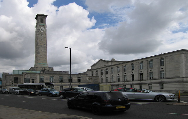
Southampton Civic Centre
Built in the early 1930s to house the Borough Council, the complex is now a mixture of performing venues, museums and City Council offices. The guildhall itself is at the centre of the complex, behind the west and south wings shown here. This is the view from the southwest, across Havelock Road.
 Map © Crown Copyright")
TIP: Click the map for more Large scale mapping
- Grid Square
- SU4112, 947 images (more nearby 🔍)
- Photographer
- Rudi Winter (more nearby)
- Date Taken
- Saturday, 28 June, 2014 (more nearby)
- Submitted
- Sunday, 10 August, 2014
- Subject Location
-
OSGB36:
 SU 4177 1218 [10m precision]
WGS84: 50:54.4551N 1:24.4376W - Camera Location
-
OSGB36: SU 4173 1213
- View Direction
- Northeast (about 45 degrees)