J3275 : Site for social housing, Crumlin Road, Belfast (September 2014)
taken 10 years ago, near to Belfast, Co Antrim, Northern Ireland
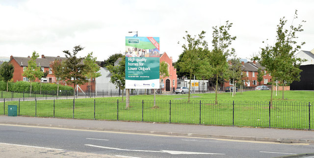
Site for social housing, Crumlin Road, Belfast (September 2014)
Vacant ground (once numbered, I think, 63-73) at the corner of the Crumlin Road (foreground) and Cliftonpark Avenue. The sign advises that it's the site for High quality homes for the Lower Oldpark. This photograph appears as a matter of geographical and historical record only. I have no connection with the Clanmill Housing Association.
![Creative Commons Licence [Some Rights Reserved]](https://s1.geograph.org.uk/img/somerights20.gif)
|
· Find out How to reuse this image ·
Share:
|
|||||
| Start a discussion on J3275 | Suggest an update to this image | Contact the contributor | |||
Loading map... (JavaScript required)
- Grid Square
- J3275, 96 images (more nearby
 )
)
- Photographer
- Albert Bridge (find more nearby)
- Date Taken
- Wednesday, 10 September, 2014 (more nearby)
- Submitted
- Wednesday, 10 September, 2014
- Geographical Context
- Place (from Tags)
- Primary Subject of Photo
- Subject Location
-
Irish:
 J 328 754 [100m precision]
WGS84: 54:36.5664N 5:56.7148W - Camera Location
-
Irish: J 328 753
- View Direction
- NORTH (about 0 degrees)
Other Tags
Image classification(about):
Geograph
This page has been viewed about 57 times.
View this location:
KML (Google Earth) ·
Google Maps ·
Bing Maps ·
Geograph Coverage Map ·
More Links for this image
·
Bing Maps ·
Geograph Coverage Map ·
More Links for this image