2014
SY8080 : Milky sea, St. Oswald's Bay, near Lulworth, Dorset
taken 10 years ago, near to West Lulworth, Dorset, England
Milky sea, St. Oswald's Bay, near Lulworth, Dorset
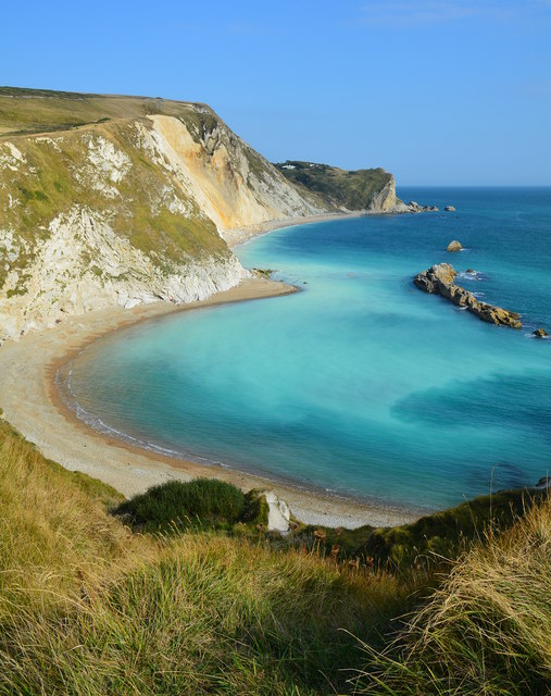
The whole bay here is called St. Oswald's bay, with the nearer half known as Man O' War Bay, which faces the Man O' War Rocks seen in the sea.
A large cliff fall occurred in 2013, and the rubble is still visible on the shore in the far part of the bay, where the cliffs are stained yellow.
The milky white sea is caused by fine particles of chalk from the rock fall, and it is easy to see the current drawing the chalk out to sea and along the shore towards the viewer.
A closer view of the landslip can be seen in SY8180 : Landslip at St. Oswald's Bay, near Lulworth, Dorset. The photo also includes some people, giving a sense of the scale of the collapse.
 Map © Crown Copyright")
TIP: Click the map for more Large scale mapping
- Grid Square
- SY8080, 415 images (more nearby 🔍)
- Photographer
- Edmund Shaw (more nearby)
- Date Taken
- Tuesday, 16 September, 2014 (more nearby)
- Submitted
- Wednesday, 17 September, 2014
- Subject Location
-
OSGB36:
 SY 8084 8021 [10m precision]
WGS84: 50:37.2766N 2:16.3324W - Camera Location
-
OSGB36: SY 8070 8029
- View Direction
- East-southeast (about 112 degrees)