J3934 : Wateresk standing stone near Dundrum
taken 9 years ago, near to Maghera, Co Down, Northern Ireland
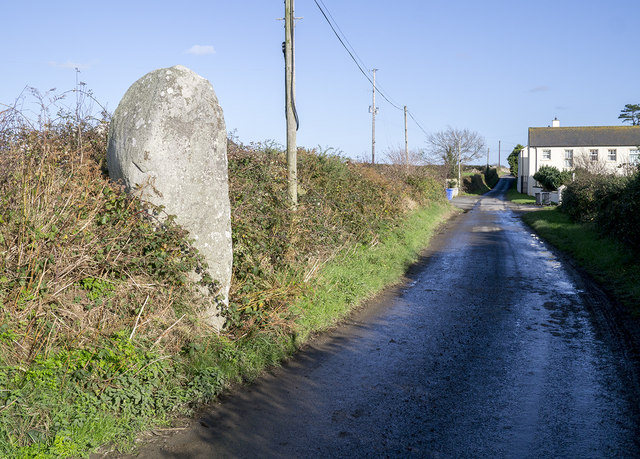
Wateresk standing stone near Dundrum
Standing stone (one of two but the other is smaller and hidden inside the hedge) on the Flush Road near the village of Maghera in County Down. It is the remains of a large megalithic structure close to a souterrain in a nearby field.
![Creative Commons Licence [Some Rights Reserved]](https://s1.geograph.org.uk/img/somerights20.gif)
|
· Find out How to reuse this image ·
Share:
|
|||||
| Start a discussion on J3934 | Suggest an update to this image | Contact the contributor | |||
Loading map... (JavaScript required)
- Grid Square
- J3934, 75 images (more nearby
 )
)
- Photographer
- Rossographer (find more nearby)
- Date Taken
- Wednesday, 5 November, 2014 (more nearby)
- Submitted
- Friday, 14 November, 2014
- Geographical Context
- Subject Location
-
Irish:
 J 39088 34210 [1m precision]
WGS84: 54:14.2738N 5:52.0474W - Camera Location
-
Irish: J 3908 3420
- View Direction
- East-northeast (about 67 degrees)
Other Tags
Image classification(about):
Geograph
This page has been viewed about 119 times.
View this location:
KML (Google Earth) ·
Google Maps ·
Bing Maps ·
Geograph Coverage Map ·
More Links for this image
·
Bing Maps ·
Geograph Coverage Map ·
More Links for this image