2014
TF3287 : The Mill
taken 10 years ago, near to Louth, Lincolnshire, England
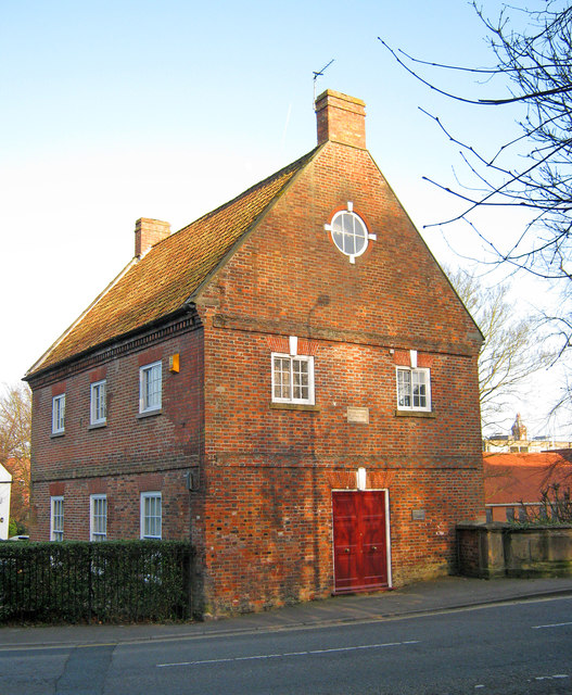
The Mill
Situated on the River Ludd on Bridge Street. This Grade II Listed mill house was built in 1742 and has a plaque inscribed 'Fran Julian Engineer 1755' above the door. It was converted by the Civic Trust in 1975 for the people of Louth and is now a private home.
 Map © Crown Copyright")
TIP: Click the map for more Large scale mapping
- Grid Square
- TF3287, 404 images (more nearby 🔍)
- Photographer
- Trevor Rickard (more nearby)
- Date Taken
- Wednesday, 12 March, 2014 (more nearby)
- Submitted
- Monday, 22 December, 2014
- Subject Location
-
OSGB36:
 TF 325 875 [100m precision]
WGS84: 53:22.0752N 0:0.5236W - Camera Location
-
OSGB36: TF 325 875
- View Direction
- East-southeast (about 112 degrees)