M2925 : River Corrib
taken 10 years ago, near to Salthill, Co Galway, Ireland
This is 1 of 10 images, with title River Corrib in this square
River Corrib
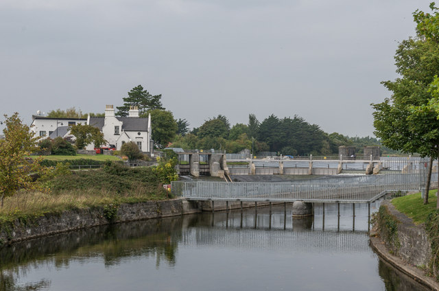
Looking upstream from Salmon Weir Bridge towards the Salmon Weir which divides the Upper River Corrib from the Lower River Corrib. In the left background is the Western Fisheries Board building, dating from 1899 and included in the National Inventory of Architectural Heritage - see Link .
.
![Creative Commons Licence [Some Rights Reserved]](https://s1.geograph.org.uk/img/somerights20.gif)
|
· Find out How to reuse this image ·
Share:
|
|||||
| Start a discussion on M2925 | Suggest an update to this image | Contact the contributor | |||
Loading map... (JavaScript required)
- Grid Square
- M2925, 470 images (more nearby
 )
)
- Photographer
- Ian Capper (find more nearby)
- Date Taken
- Friday, 12 September, 2014 (more nearby)
- Submitted
- Wednesday, 14 January, 2015
- Geographical Context
- Place (from Tags)
- River (from Tags)
- Subject Location
-
Irish:
 M 296 257 [100m precision]
WGS84: 53:16.6485N 9:3.3611W - Camera Location
-
Irish: M 296 255
- View Direction
- NORTH (about 0 degrees)
Other Tags
Image classification(about):
Geograph
This page has been viewed about 46 times.
View this location:
KML (Google Earth) ·
Google Maps ·
Bing Maps ·
Geograph Coverage Map ·
More Links for this image