J2725 : Path descending along the line of Batt's Wall
taken 11 years ago, 6 km N of Attical, Co Down, Northern Ireland
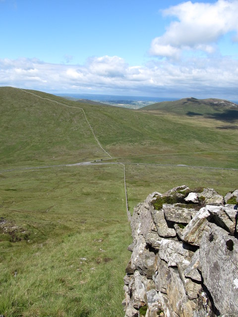
Path descending along the line of Batt's Wall
There is sketchy path leading down to the parking area on the old Hilltown Road off the Moyad Road.
Batt's Wall :: J2825
Batt's Wall is a dry stone wall in the western Mourne Mountains. It was built by Narcissus Batt of Purdysburn during the famine years in the mid 19th Century, probably as a work relief project. The wall runs from Tievedockdaragh to Slieve Muck.
![Creative Commons Licence [Some Rights Reserved]](https://s1.geograph.org.uk/img/somerights20.gif)
|
· Find out How to reuse this image ·
Share:
|
|||||
| Start a discussion on J2725 | Suggest an update to this image | Contact the contributor | |||
Loading map... (JavaScript required)
- Grid Square
- J2725, 45 images (more nearby
 )
)
- Photographer
- Eric Jones (find more nearby)
- Date Taken
- Thursday, 13 June, 2013 (more nearby)
- Submitted
- Thursday, 22 January, 2015
- Geographical Context
- Subject Location
-
Irish:
 J 275 251 [100m precision]
WGS84: 54:9.5838N 6:2.8789W - Camera Location
-
Irish: J 276 251
- View Direction
- West-northwest (about 292 degrees)
Image classification(about):
Geograph
This page has been viewed about 58 times.
View this location:
KML (Google Earth) ·
Google Maps ·
Bing Maps ·
Geograph Coverage Map ·
More Links for this image
·
Bing Maps ·
Geograph Coverage Map ·
More Links for this image