J0515 : The Kilnasaggart Road near Jonesborough
taken 9 years ago, near to Jonesborough, Co Armagh, Northern Ireland
The Kilnasaggart Road near Jonesborough
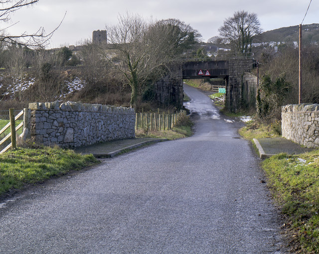
The Kilnasaggart Road at the Gap of the North a few hundred metres north of the border. The railway bridge ahead carries the Belfast-Dublin line and was the location of many a bomb or incident during the 'Troubles'. Moyry Castle J0514 : Moyry Castle, seen on the upper left of picture, is just behind.
![Creative Commons Licence [Some Rights Reserved]](https://s1.geograph.org.uk/img/somerights20.gif)
|
· Find out How to reuse this image ·
Share:
|
|||||
| Start a discussion on J0515 | Suggest an update to this image | Contact the contributor | |||
Loading map... (JavaScript required)
- Grid Square
- J0515, 21 images (more nearby
 )
)
- Photographer
- Rossographer (find more nearby)
- Date Taken
- Saturday, 31 January, 2015 (more nearby)
- Submitted
- Wednesday, 4 February, 2015
- Geographical Context
- Subject Location
-
Irish:
 J 059 150 [100m precision]
WGS84: 54:4.4202N 6:22.9404W - Camera Location
-
Irish: J 059 150
- View Direction
- Southwest (about 225 degrees)
Other Tags
Image classification(about):
Geograph (Third Visitor for J0515)
This page has been viewed about 60 times.
View this location:
KML (Google Earth) ·
Google Maps ·
Bing Maps ·
Geograph Coverage Map ·
More Links for this image
·
Bing Maps ·
Geograph Coverage Map ·
More Links for this image