J3763 : Cathodic protection marker post, Killinure near Carryduff (February 2015)
taken 9 years ago, near to Carryduff, Co Down, Northern Ireland
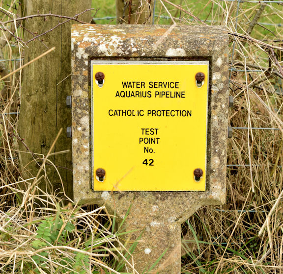
Cathodic protection marker post, Killinure near Carryduff (February 2015)
A post marking a cathodic protection Link test point on the western side of the Killynure Road. The Aquarius pipeline was Aquarius 3 was a Design and Build contract for a £23m water treatment works in County Down, Northern Ireland. The 155MLD plant was designed to supply 50% of the water to Greater Belfast and County Down and meet the very latest EU standards. This was one of the largest WTW to be built in Northern Ireland in the last 30 years and incorporated the latest technology to deal with cryptosporidium. See Link (Archive Link ) .
The Killynure Road, Carryduff/Saintfield
A minor road running south east from Carryduff to the Old Belfast Road at Saintfield. Once the main road to the county town of Downpatrick and now the back road to Saintfield.
![Creative Commons Licence [Some Rights Reserved]](https://s1.geograph.org.uk/img/somerights20.gif)
|
· Find out How to reuse this image ·
Share:
|
|||||
| Start a discussion on J3763 | Suggest an update to this image | Contact the contributor | |||
Loading map... (JavaScript required)
- Grid Square
- J3763, 7 images (more nearby
 )
)
- Photographer
- Albert Bridge (find more nearby)
- Date Taken
- Wednesday, 18 February, 2015 (more nearby)
- Submitted
- Wednesday, 18 February, 2015
- Geographical Context
- Place (from Tags)
- Subject Location
-
Irish:
 J 377 633 [100m precision]
WGS84: 54:29.9922N 5:52.5155W - Camera Location
-
Irish: J 377 633
- View Direction
- WEST (about 270 degrees)
Other Tags
Image classification(about):
Supplemental image
This page has been viewed about 137 times.
View this location:
KML (Google Earth) ·
Google Maps ·
Bing Maps ·
Geograph Coverage Map ·
More Links for this image