2014

SP2965 : Circle at Bridge 46, Emscote Road crossing of Grand Union Canal, Warwick

taken 10 years ago, near to Warwick, Warwickshire, England
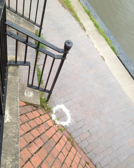
Circle at Bridge 46, Emscote Road crossing of Grand Union Canal, Warwick
Looking down on the towpath from the bridge parapet.
A geography of white powder

These small piles of white powder – resembling flour – are encountered in this area. They are often at the base of lighting columns and telephone poles. They seem to form a series. What do they signify?

A shared jogging route?
A Walking for Health circuit?
A low-level treasure hunt or geocaching game?
"This way to the drugs"?
Dog repellent?
Disinfectant?
Tarmac solvent?


Creative Commons Licence [Some Rights Reserved]   © Copyright Robin Stott and licensed for reuse under this Creative Commons Licence.
Geographical Context: Lowlands Paths Suburb, Urban fringe Canals Canal: Grand Union Place: Warwick other tags: Riverside Walk Postcode Area CV34 Circle Click a tag, to view other nearby images.
This photo is linked from: Automatic Clusters: · Warwick [1399] · Emscote [588] · Emscote Road [361] · Bridge [227] · Grand Union Canal [173] ·
1:50,000 Modern Day Landranger(TM) Map © Crown Copyright
+
1:50,000 Modern Day Landranger(TM) Map © Crown Copyright
TIP: Click the map for more Large scale mapping
Grid Square
SP2965, 1818 images   (more nearby 🔍)
Photographer
Robin Stott   (more nearby)
Date Taken
Tuesday, 22 April, 2014   (more nearby)
Submitted
Wednesday, 18 February, 2015
Subject Location
OSGB36: geotagged! SP 29766 65568 [1m precision]
WGS84: 52:17.2469N 1:33.9027W
Camera Location
OSGB36: geotagged! SP 29766 65568
View Direction
Southeast (about 135 degrees)
Clickable map
+
NW N NE
W Go E
SW S SE
Image classification(about): Supplemental image
This page has been viewed about 30 times
You are not logged in login | register