J3574 : The Ballymacarrett Walkway, Belfast (February 2015)
taken 9 years ago, near to Belfast, Co Antrim, Northern Ireland
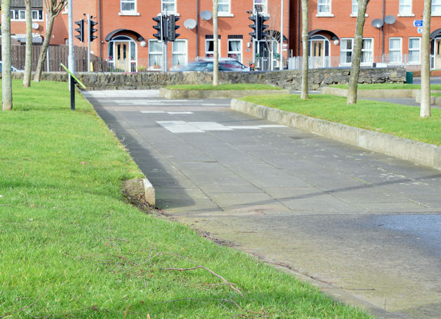
The Ballymacarrett Walkway, Belfast (February 2015)
The former route of the Belfast and County Down Railway, looking towards Dee Street, now a footpath and part of National Cycle Network route 99. It continues towards Dundonald and Comber as the Comber Greenway J3773 : Spring on the Comber Greenway, Belfast 2011 (1) and J4470 : The start of the Comber Greenway, Comber. J3674 : The Ballymacarrett Walkway, Belfast (January 2011) shows the view in the opposite direction.
The Belfast and County Down Railway
The Belfast and County Down Railway ran from Queens Quay station in Belfast to Castlewellan via Comber, Downpatrick and Newcastle. There were also lines from Comber to Donaghadee via Newtownards, Belfast to Bangor and branches from Ballynahinch Jct to Ballynahinch and Downpatrick to Ardglass. The lines opened between 1848 and 1892. All closed by 1950 except for Castlewellan Newcastle which survived until 1955 as part of the GNR(I) route from Belfast via Banbridge and the Bangor line which remains open but from Belfast Central.
![Creative Commons Licence [Some Rights Reserved]](https://s1.geograph.org.uk/img/somerights20.gif)
|
· Find out How to reuse this image ·
Share:
|
|||||
| Start a discussion on J3574 | Suggest an update to this image | Contact the contributor | |||
Loading map... (JavaScript required)
- Grid Square
- J3574, 516 images (more nearby
 )
)
- Photographer
- Albert Bridge (find more nearby)
- Date Taken
- Thursday, 19 February, 2015 (more nearby)
- Submitted
- Thursday, 19 February, 2015
- Geographical Context
- Place (from Tags)
- Primary Subject of Photo
- Subject Location
-
Irish:
 J 359 745 [100m precision]
WGS84: 54:36.0582N 5:53.8061W - Camera Location
-
Irish: J 359 745
- View Direction
- West-northwest (about 292 degrees)
Other Tags
Image classification(about):
Geograph
This page has been viewed about 235 times.
View this location:
KML (Google Earth) ·
Google Maps ·
Bing Maps ·
Geograph Coverage Map ·
More Links for this image
·
Bing Maps ·
Geograph Coverage Map ·
More Links for this image