J4773 : Development site, Scrabo Road, Newtownards - February 2015(1)
taken 9 years ago, near to Newtownards, Co Down, Northern Ireland
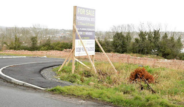
Development site, Scrabo Road, Newtownards - February 2015(1)
The site and the agents for sale board on the Scrabo Road.
The Knightsbridge site, Newtownards
A site, on the Scrabo Road, once occupied by the Knightsbridge Inn and currently (February 2015) offered for sale. Described on the agents board as having planning permission for 22 houses.
Note added 13 April 2017 the site had the following planning permission (18 April 2011) X/2010/0180/RM 22 No. dwellings with associated access improvements and landscaping. Land opposite 179/181 Scrabo Road, Newtownards.
The photographs submitted by me appear as a matter of record only. I have no connection with any of the parties involved in the sale.
![Creative Commons Licence [Some Rights Reserved]](https://s1.geograph.org.uk/img/somerights20.gif)
|
· Find out How to reuse this image ·
Share:
|
|||||
| Start a discussion on J4773 | Suggest an update to this image | Contact the contributor | |||
Loading map... (JavaScript required)
- Grid Square
- J4773, 67 images (more nearby
 )
)
- Photographer
- Albert Bridge (find more nearby)
- Date Taken
- Thursday, 26 February, 2015 (more nearby)
- Submitted
- Thursday, 26 February, 2015
- Geographical Context
- Place (from Tags)
- Subject Location
-
Irish:
 J 479 730 [100m precision]
WGS84: 54:35.0379N 5:42.7389W - Camera Location
-
Irish: J 479 730
- View Direction
- North-northeast (about 22 degrees)
Other Tags
Image classification(about):
Geograph
This page has been viewed about 290 times.
View this location:
KML (Google Earth) ·
Google Maps ·
Bing Maps ·
Geograph Coverage Map ·
More Links for this image
·
Bing Maps ·
Geograph Coverage Map ·
More Links for this image