2015

TQ0821 : Muddy Junction

taken 9 years ago, near to Gay Street, West Sussex, England
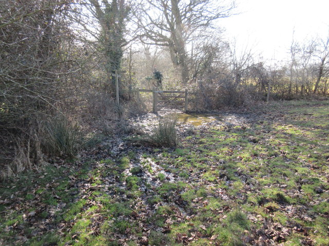
Muddy Junction
Muddy Junction
Public bridleway 2307 continues south towards Sand Pond Cottage and public footpath 2308/2 proceeds east towards Westlands Farm.

Creative Commons Licence [Some Rights Reserved]   © Copyright Peter Holmes and licensed for reuse under this Creative Commons Licence.
Geographical Context: Paths Grassland Primary Subject: Path Junction other tags: Muddy Gateway Click a tag, to view other nearby images.
This photo is linked from: Automatic Clusters: · Footpath [7] · Bridleway [6] · Junction [4] · Continues [2] · Muddy [2] · Pond [2] Other Photos: · Footpath arrives at muddy corner of field and junction with bridleway ·
1:50,000 Modern Day Landranger(TM) Map © Crown Copyright
+
+
1:50,000 Modern Day Landranger(TM) Map © Crown Copyright
TIP: Click the map for more Large scale mapping
Grid Square
TQ0821, 14 images   (more nearby 🔍)
Photographer
Peter Holmes   (more nearby)
Date Taken
Saturday, 7 March, 2015   (more nearby)
Submitted
Sunday, 8 March, 2015
Subject Location
OSGB36: geotagged! TQ 081 211 [100m precision]
WGS84: 50:58.7603N 0:27.6308W
Camera Location
OSGB36: geotagged! TQ 081 211
View Direction
South-southeast (about 157 degrees)
Clickable map
+
NW N NE
W Go E
SW S SE
Image classification(about): Geograph (Fourth Visitor for TQ0821)
This page has been viewed about 25 times
You are not logged in login | register