J6086 : Mew Island Lighthouse
taken 17 years ago, 6 km N of Donaghadee, Co Down, Northern Ireland
This is 1 of 14 images, with title Mew Island Lighthouse in this square
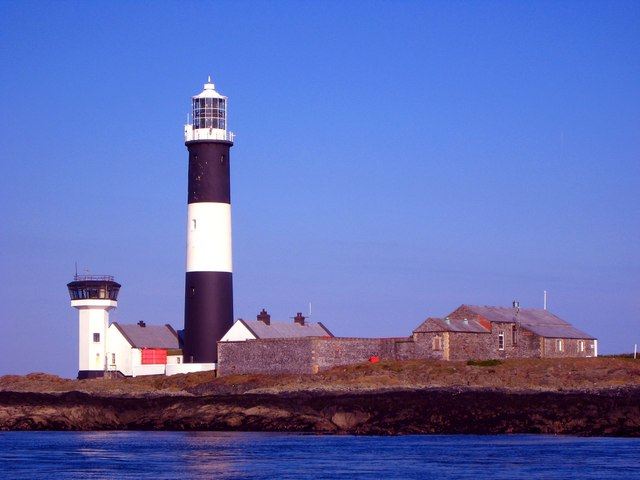
Mew Island Lighthouse
Mew Island Lighthouse, part of the Copeland Islands. The present lighthouse and fog signal on Mew Island was established on 1st November 1884 and its predecessor on nearby Lighthouse Island was discontinued.
![Creative Commons Licence [Some Rights Reserved]](https://s1.geograph.org.uk/img/somerights20.gif)
|
· Find out How to reuse this image ·
Share:
|
|||||
| Start a discussion on J6086 | Suggest an update to this image | Contact the contributor | |||
Loading map... (JavaScript required)
- Grid Square
- J6086, 29 images (more nearby
 )
)
- Photographer
- Rossographer (find more nearby)
- Date Taken
- Friday, 1 June, 2007 (more nearby)
- Submitted
- Sunday, 3 June, 2007
- Category
- Lighthouse (more nearby)
- Subject Location
-
Irish:
 J 60289 86162 [1m precision]
WGS84: 54:41.8784N 5:30.8684W - View Direction
- Northeast (about 45 degrees)
This page has been viewed about 1785 times.
View this location:
KML (Google Earth) ·
Google Maps ·
Bing Maps ·
Geograph Coverage Map ·
More Links for this image
·
Bing Maps ·
Geograph Coverage Map ·
More Links for this image