J5572 : National Cycle Network sign, Ballyblack near Carrowdore - June 2015(1)
taken 9 years ago, 3 km from Carrowdore, Co Down, Northern Ireland
National Cycle Network sign, Ballyblack near Carrowdore - June 2015(1)
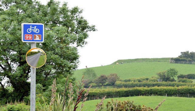
A National Cycle Network Route 99 sign on the Ballyblack Road immediately east of the Ballycastle Road. This part of the route passes through the low drumlins of the northern Ards Peninsula.
![Creative Commons Licence [Some Rights Reserved]](https://s1.geograph.org.uk/img/somerights20.gif)
|
· Find out How to reuse this image ·
Share:
|
|||||
| Start a discussion on J5572 | Suggest an update to this image | Contact the contributor | |||
Loading map... (JavaScript required)
- Grid Square
- J5572, 6 images (more nearby
 )
)
- Photographer
- Albert Bridge (find more nearby)
- Date Taken
- Wednesday, 24 June, 2015 (more nearby)
- Submitted
- Monday, 29 June, 2015
- Geographical Context
- Place (from Tags)
- Primary Subject of Photo
- Subject Location
-
Irish:
 J 550 728 [100m precision]
WGS84: 54:34.8137N 5:36.1709W - Camera Location
-
Irish: J 550 728
- View Direction
- East-southeast (about 112 degrees)
Other Tags
Image classification(about):
Geograph
This page has been viewed about 34 times.
View this location:
KML (Google Earth) ·
Google Maps ·
Bing Maps ·
Geograph Coverage Map ·
More Links for this image
·
Bing Maps ·
Geograph Coverage Map ·
More Links for this image