2015
SU8591 : High Wycombe: Early industrial units on Lancaster Road
taken 9 years ago, near to Booker, Buckinghamshire, England
High Wycombe: Early industrial units on Lancaster Road
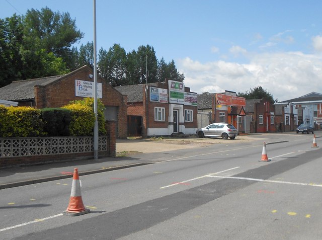
These six small industrial units were probably the earliest buildings on the Cressex Industrial Estate, now the Cressex Business Park. The 1938 Edition of the large scale Ordnance Survey map does not show them but the 1960 version certainly does, dating them probably to the 1950s.
The cones in the centre of the road were demarcating temporary one-way traffic workings while an underground service was being laid, as evidenced by the new trench scar in the foreground, when the photograph was taken.
The cones in the centre of the road were demarcating temporary one-way traffic workings while an underground service was being laid, as evidenced by the new trench scar in the foreground, when the photograph was taken.
 Map © Crown Copyright")
TIP: Click the map for more Large scale mapping
- Grid Square
- SU8591, 56 images (more nearby 🔍)
- Photographer
- Nigel Cox (more nearby)
- Date Taken
- Saturday, 25 July, 2015 (more nearby)
- Submitted
- Tuesday, 28 July, 2015
- Subject Location
-
OSGB36:
 SU 8532 9185 [10m precision]
WGS84: 51:37.1410N 0:46.1418W - Camera Location
-
OSGB36: SU 8536 9185
- View Direction
- WEST (about 270 degrees)