2015
TQ3981 : Platform, Canning Town DLR Station
taken 9 years ago, near to Blackwall Tunnel, Greenwich, England
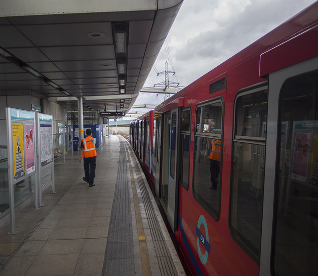
Platform, Canning Town DLR Station
Platform 3 at Canning Town DLR station with an eastbound train ready to depart.
Docklands Light Railway (DLR)
The Docklands Light Railway is an automated light metro or light rail system opened on 31 August 1987 to serve the redeveloped Docklands area of London. It covers several areas of London, reaching north to Stratford, south to Lewisham, west to Tower Gateway and Bank in the City of London financial district, and east to Beckton, London City Airport and Woolwich Arsenal. It has been extended several times and now has 40 stations and carries over 60 million passengers a year.
Website: Link
Wikipedia: Link
 Map © Crown Copyright")
TIP: Click the map for more Large scale mapping
- Grid Square
- TQ3981, 458 images (more nearby 🔍)
- Photographer
- Rossographer (more nearby)
- Date Taken
- Sunday, 12 July, 2015 (more nearby)
- Submitted
- Tuesday, 4 August, 2015
- Subject Location
-
OSGB36:
 TQ 3948 8133 [10m precision]
WGS84: 51:30.8211N 0:0.5203E - Camera Location
-
OSGB36: TQ 3949 8132
- View Direction
- North-northwest (about 337 degrees)