R3377 : Ennis - Friary ruins
taken 9 years ago, near to Ennis, Co Clare, Ireland
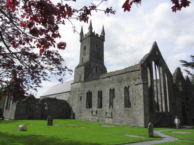
Ennis - Friary ruins
The Friary was built about 1242 but is now largely ruinous but is open to the public.
![Creative Commons Licence [Some Rights Reserved]](https://s1.geograph.org.uk/img/somerights20.gif)
|
· Find out How to reuse this image ·
Share:
|
|||||
| Start a discussion on R3377 | Suggest an update to this image | Contact the contributor | |||
Loading map... (JavaScript required)
- Grid Square
- R3377, 566 images (more nearby
 )
)
- Photographer
- Colin Park (find more nearby)
- Date Taken
- Thursday, 7 May, 2015 (more nearby)
- Submitted
- Sunday, 30 August, 2015
- Geographical Context
- Primary Subject of Photo
- Subject Location
-
Irish:
 R 339 776 [100m precision]
WGS84: 52:50.7592N 8:58.8798W - Camera Location
-
Irish: R 339 776
- View Direction
- Northwest (about 315 degrees)
Image classification(about):
Geograph
This page has been viewed about 62 times.
View this location:
KML (Google Earth) ·
Google Maps ·
Bing Maps ·
Geograph Coverage Map ·
More Links for this image
·
Bing Maps ·
Geograph Coverage Map ·
More Links for this image