D4303 : Sea Wall, English's Bay, Islandmagee
taken 17 years ago, near to Ballylumford, Co Antrim, Northern Ireland
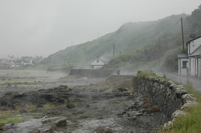
Sea Wall, English's Bay, Islandmagee
On a hot, yet soaking wet, day, mist rises from the foreshore and road in English's Bay
![Creative Commons Licence [Some Rights Reserved]](https://s1.geograph.org.uk/img/somerights20.gif)
|
· Find out How to reuse this image ·
Share:
|
|||||
| Start a discussion on D4303 | Suggest an update to this image | Contact the contributor | |||
Loading map... (JavaScript required)
- Grid Square
- D4303, 23 images (more nearby
 )
)
- Photographer
- Robin Somes (find more nearby)
- Date Taken
- Tuesday, 12 June, 2007 (more nearby)
- Submitted
- Monday, 18 June, 2007
- Category
- Sea wall (more nearby)
- Subject Location
-
Irish:
 D 431 030 [100m precision]
WGS84: 54:51.2571N 5:46.3539W - Camera Location
-
Irish: D 431 030
- View Direction
- Southeast (about 135 degrees)
Image classification(about):
Geograph (Third Visitor for D4303)
This page has been viewed about 393 times.
View this location:
KML (Google Earth) ·
Google Maps ·
Bing Maps ·
Geograph Coverage Map ·
More Links for this image
·
Bing Maps ·
Geograph Coverage Map ·
More Links for this image