2015
SO1191 : Royal Welsh Warehouse viewed from Barn Lane
taken 8 years ago, near to Newtown/Y Drenewydd, Powys, Wales
This is 1 of 2 images, with title Royal Welsh Warehouse viewed from Barn Lane in this square
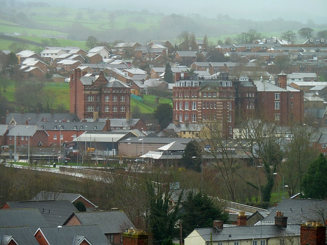
Royal Welsh Warehouse viewed from Barn Lane
The two large Victorian buildings in the centre of the photo are Agricultural House Link (Archive Link ) and the Royal Welsh Warehouse Link (Archive Link ) , both were built for the Pryce Jones mail-order business in the 19th century and are sited very close to the railway station.
Behind these buildings lies part of the 1970s built 'new town' of Treowen. Between the Royal Welsh Warehouse and the camera is the McDonald's Restaurant and drive-thru (with pyramidal roof) which stands close to the River Severn on the site of a large laundry. The Cambrian Bridge stretches across the river just in front of McDonald's.
Behind these buildings lies part of the 1970s built 'new town' of Treowen. Between the Royal Welsh Warehouse and the camera is the McDonald's Restaurant and drive-thru (with pyramidal roof) which stands close to the River Severn on the site of a large laundry. The Cambrian Bridge stretches across the river just in front of McDonald's.
 Map © Crown Copyright")
TIP: Click the map for more Large scale mapping
- Grid Square
- SO1191, 320 images (more nearby 🔍)
- Photographer
- Penny Mayes (more nearby)
- Date Taken
- Friday, 25 December, 2015 (more nearby)
- Submitted
- Monday, 11 January, 2016
- Subject Location
-
OSGB36:
 SO 111 913 [100m precision]
WGS84: 52:30.7824N 3:18.6406W - Camera Location
-
OSGB36: SO 113 919
- View Direction
- South-southwest (about 202 degrees)