2016
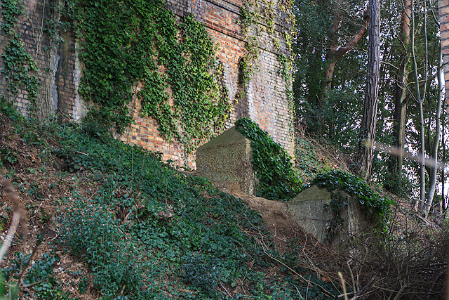
SZ0692 : WWII defences in the environs of Bournemouth & Christchurch: Bourne Valley viaducts - cubes (3)
taken 8 years ago, near to Branksome, Bournemouth, Christchurch & Poole, England
WWII defences in the environs of Bournemouth & Christchurch: Bourne Valley viaducts - cubes (3)
-
Anti-tank Blocks: DoB ID: e41546
Two anti-tank blocks under an arch of the disused viaduct on the N side of Surrey Road.
SZ1292 : WWII defences in the environs of Bournemouth & Christchurch: Pokesdown - pillbox (1)
Anti-tank Blocks: DoB ID: e41546
Two anti-tank blocks under an arch of the disused viaduct on the N side of Surrey Road.
SZ1292 : WWII defences in the environs of Bournemouth & Christchurch: Pokesdown - pillbox (1)
 Map © Crown Copyright")
TIP: Click the map for more Large scale mapping
- Grid Square
- SZ0692, 124 images (more nearby 🔍)
- Photographer
- Mike Searle (more nearby)
- Date Taken
- Friday, 4 March, 2016 (more nearby)
- Submitted
- Monday, 7 March, 2016
- Subject Location
-
OSGB36:
 SZ 0626 9221 [10m precision]
WGS84: 50:43.7685N 1:54.7602W - Camera Location
-
OSGB36: SZ 0626 9220
- View Direction
- East-northeast (about 67 degrees)