2016
SZ2692 : WWII coastal defences of SW Hampshire today - Taddiford Gap anti-tank cubes (3)
taken 8 years ago, near to Downton, Hampshire, England
WWII coastal defences of SW Hampshire today - Taddiford Gap anti-tank cubes (3)
-
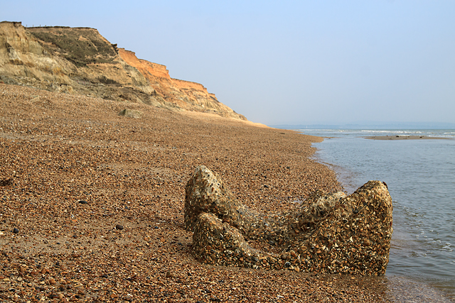
Anti-tank Block: DoB ID: S0000504
This block is only uncovered at low tide, and the effects of almost constant wave action upon it can clearly be seen.
SZ2792 : WWII coastal defences of SW Hampshire today - Hordle Cliff pillbox ruins?
Anti-tank Block: DoB ID: S0000504
This block is only uncovered at low tide, and the effects of almost constant wave action upon it can clearly be seen.
SZ2792 : WWII coastal defences of SW Hampshire today - Hordle Cliff pillbox ruins?
 Map © Crown Copyright")
TIP: Click the map for more Large scale mapping
- Grid Square
- SZ2692, 60 images (more nearby 🔍)
- Photographer
- Mike Searle (more nearby)
- Date Taken
- Wednesday, 23 March, 2016 (more nearby)
- Submitted
- Friday, 25 March, 2016
- Subject Location
-
OSGB36:
 SZ 2609 9230 [10m precision]
WGS84: 50:43.7842N 1:37.9023W - Camera Location
-
OSGB36: SZ 2609 9231
- View Direction
- South-southeast (about 157 degrees)