J3373 : Two-way cycle lane, Upper Arthur Street, Belfast (April 2016)
taken 8 years ago, near to Belfast, Co Antrim, Northern Ireland
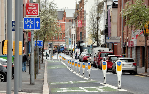
Two-way cycle lane, Upper Arthur Street, Belfast (April 2016)
A new two-way cycle lane now open at Upper Arthur Street. J3373 : Upper Arthur Street shows it under construction on 4 March 2016 and J3374 : Upper Arthur Street, Belfast shows a before view in March 2008. See also J3373 : Two-way cycle lane, Alfred Street, Belfast (April 2016).
![Creative Commons Licence [Some Rights Reserved]](https://s1.geograph.org.uk/img/somerights20.gif)
|
· Find out How to reuse this image ·
Share:
|
|||||
|
There are 2 posts in a
discussion on J3373 (preview on the left) |
Suggest an update to this image | Contact the contributor | |||
Loading map... (JavaScript required)
- Grid Square
- J3373, 2776 images (more nearby
 )
)
- Photographer
- Albert Bridge (find more nearby)
- Date Taken
- Sunday, 24 April, 2016 (more nearby)
- Submitted
- Monday, 25 April, 2016
- Geographical Context
- Place (from Tags)
- Primary Subject of Photo
- Subject Location
-
Irish:
 J 339 739 [100m precision]
WGS84: 54:35.7721N 5:55.6592W - Camera Location
-
Irish: J 339 739
- View Direction
- NORTH (about 0 degrees)
Other Tags
Image classification(about):
Geograph
This page has been viewed about 62 times.
View this location:
KML (Google Earth) ·
Google Maps ·
Bing Maps ·
Geograph Coverage Map ·
More Links for this image
·
Bing Maps ·
Geograph Coverage Map ·
More Links for this image