V5042 : Isolated rock at Ballaghboy
taken 8 years ago, 8 km WSW of Allihies, Co Cork, Ireland
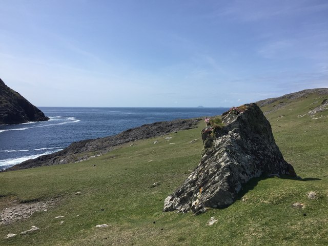
Isolated rock at Ballaghboy
Looking westwards from the path that leads over the hill to Garinish from the cable car housing. The northern tip of Dursey Island, known as Mealaun Point, is visible across Dursey Sound. On the horizon the two Skellig islands can just be seen.
![Creative Commons Licence [Some Rights Reserved]](https://s1.geograph.org.uk/img/somerights20.gif)
|
· Find out How to reuse this image ·
Share:
|
|||||
| Start a discussion on V5042 | Suggest an update to this image | Contact the contributor | |||
Loading map... (JavaScript required)
- Grid Square
- V5042, 2 images (more nearby
 )
)
- Photographer
- Bob Jones (find more nearby)
- Date Taken
- Monday, 23 May, 2016 (more nearby)
- Submitted
- Friday, 10 June, 2016
- Geographical Context
- Primary Subject of Photo
- Subject Location
-
Irish:
 V 506 421 [100m precision]
WGS84: 51:36.7735N 10:9.4287W - Camera Location
-
Irish: V 506 421
- View Direction
- WEST (about 270 degrees)
This page has been viewed about 83 times.
View this location:
KML (Google Earth) ·
Google Maps ·
Bing Maps ·
Geograph Coverage Map ·
More Links for this image
·
Bing Maps ·
Geograph Coverage Map ·
More Links for this image