2016
SO8931 : Gupshill Manor
taken 8 years ago, near to Walton Cardiff, Gloucestershire, England
This is 1 of 6 images, with title Gupshill Manor in this square
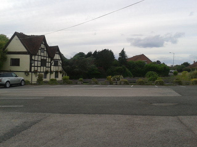
Gupshill Manor
This pub is popular, to judge by the size of its car park. The road into Tewkesbury can be seen on the right. This was once the manor house "Gupshill Manor was built in 1431, on the site of an earlier house known as Globes Hall. In 1471 the manor house was literally at the centre of one of the last, and perhaps the bloodiest battles of the War of the Roses." A fire destroyed half of the building at the beginning of the 20th century and it became a pub in the 1950s. Link
 Map © Crown Copyright")
TIP: Click the map for more Large scale mapping
- Grid Square
- SO8931, 84 images (more nearby 🔍)
- Photographer
- HelenK (more nearby)
- Date Taken
- Monday, 27 June, 2016 (more nearby)
- Submitted
- Wednesday, 29 June, 2016
- Subject Location
-
OSGB36:
 SO 8938 3142 [10m precision]
WGS84: 51:58.8682N 2:9.3622W - Camera Location
-
OSGB36: SO 8940 3138
- View Direction
- North-northwest (about 337 degrees)