J2275 : Field gate, Quarterlands, Dundrod (August 2016)
taken 8 years ago, near to Dundrod, Co Antrim, Northern Ireland
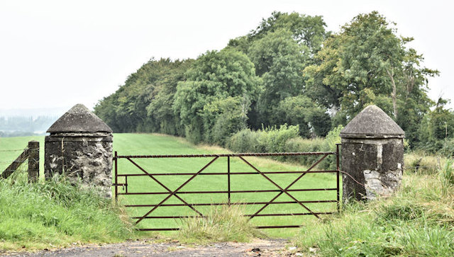
Field gate, Quarterlands, Dundrod (August 2016)
A field gate, with traditional conical-top posts, at the Quarterlands (Quarterland on the Google map) Road end of the Cochranstown Road.
![Creative Commons Licence [Some Rights Reserved]](https://s1.geograph.org.uk/img/somerights20.gif)
|
· Find out How to reuse this image ·
Share:
|
|||||
| Start a discussion on J2275 | Suggest an update to this image | Contact the contributor | |||
Loading map... (JavaScript required)
- Grid Square
- J2275, 6 images (more nearby
 )
)
- Photographer
- Albert Bridge (find more nearby)
- Date Taken
- Thursday, 18 August, 2016 (more nearby)
- Submitted
- Thursday, 18 August, 2016
- Geographical Context
- Primary Subject of Photo
- Subject Location
-
Irish:
 J 220 750 [100m precision]
WGS84: 54:36.5090N 6:6.7571W - Camera Location
-
Irish: J 220 750
- View Direction
- West-northwest (about 292 degrees)
Other Tags
This page has been viewed about 32 times.
View this location:
KML (Google Earth) ·
Google Maps ·
Bing Maps ·
Geograph Coverage Map ·
More Links for this image
·
Bing Maps ·
Geograph Coverage Map ·
More Links for this image