2016
TR3349 : Public footpath EE425: The Boot
taken 8 years ago, near to Sutton, Kent, England
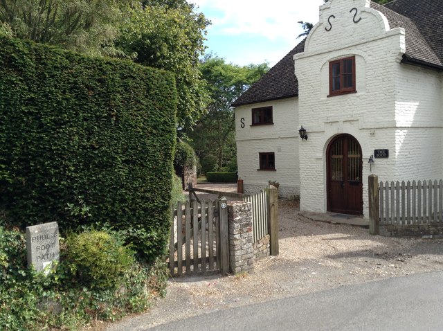
Public footpath EE425: The Boot
Public footpath EE425 leaves Church Hill through the grounds of 'The Boot', a distinctive possibly C17 house opposite the church. A side gate has been provided for pedestrians, and a concrete plinth in the hedge marks the path.
 Map © Crown Copyright")
TIP: Click the map for more Large scale mapping
- Grid Square
- TR3349, 65 images (more nearby 🔍)
- Photographer
- Hugh Craddock (more nearby)
- Date Taken
- Saturday, 3 September, 2016 (more nearby)
- Submitted
- Saturday, 10 September, 2016
- Subject Location
-
OSGB36:
 TR 3346 4937 [10m precision]
WGS84: 51:11.7495N 1:20.4055E - Camera Location
-
OSGB36: TR 3344 4937
- View Direction
- EAST (about 90 degrees)