TR3248 : Path to Maydensole
taken 8 years ago, near to West Langdon, Kent, England
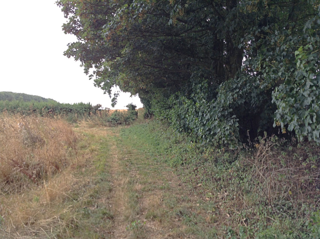
Public footpath EE417 runs southwest from Sutton Court Farm, just north of the church of St Peter and St Paul in Sutton village, to Maydensole Farm, on Roman Road in West Langdon. The path appears to be of some considerable age: it is marked on the first reliable maps of the area, including the Ordnance Survey first edition one inch map. It is also enclosed by hedges on both sides for much of the way between Sutton Court and public footpath EE419, but sufficiently narrow to exclude the likelihood that it was ever more than a bridleroad. A dogleg in the path, southwest of the intersection with EE419, marks the traverse of the former parish boundary between Sutton and Little Mongeham. The west end of the path formerly passed through the farmyard of Maydensole Farm, but now emerges onto Roman Road just to the north of the farm.
The White Cliffs Trails were created in 1987 by Dover District Council to link the towns of Dover, Deal and Sandwich, going along the famous 'white cliffs' to the east of Dover to Deal with an inland return through the beautiful Kent countryside. A link from Deal to Northbourne via Sholden and a loop from Sandwich to Northbourne via Eastry provide a range of options.
The routes are marked on OS mapping but have no apparent current publications.
 Map © Crown Copyright")
- Grid Square
- TR3248, 42 images (more nearby 🔍)
- Photographer
- Hugh Craddock (more nearby)
- Date Taken
- Saturday, 3 September, 2016 (more nearby)
- Submitted
- Saturday, 10 September, 2016
- Subject Location
-
OSGB36:
 TR 3237 4837 [10m precision]
WGS84: 51:11.2376N 1:19.4323E - Camera Location
-
OSGB36: TR 3238 4838
- View Direction
- Southwest (about 225 degrees)