J3774 : No 167 Upper Newtownards Road, Belfast (October 2016)
taken 7 years ago, 4 km E of Belfast, Co Antrim, Northern Ireland
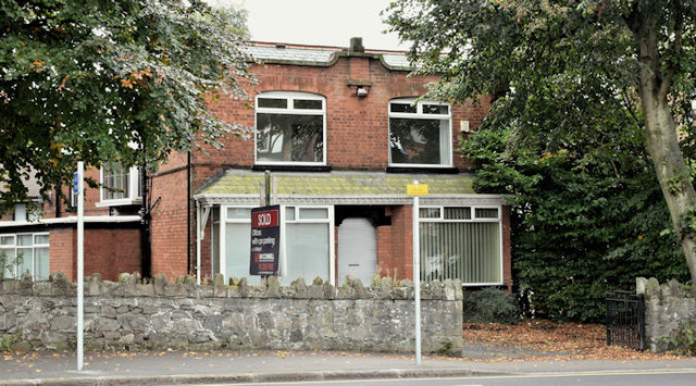
No 167 Upper Newtownards Road, Belfast (October 2016)
An extended and converted detached house, previously used as offices, now with a sold patch on the for sale sign. Described by the agents as The property comprises a self contained office building with accommodation arranged over two floors. Specification includes painted and plastered walls, carpeted floors and central heating. Toilet facilities are available on both floors. There is on site parking for 5+ cars. I have no connection with any of the parties involved in the sale.
![Creative Commons Licence [Some Rights Reserved]](https://s1.geograph.org.uk/img/somerights20.gif)
|
· Find out How to reuse this image ·
Share:
|
|||||
| Start a discussion on J3774 | Suggest an update to this image | Contact the contributor | |||
Loading map... (JavaScript required)
- Grid Square
- J3774, 464 images (more nearby
 )
)
- Photographer
- Albert Bridge (find more nearby)
- Date Taken
- Friday, 21 October, 2016 (more nearby)
- Submitted
- Friday, 21 October, 2016
- Geographical Context
- Place (from Tags)
- Subject Location
-
Irish:
 J 374 740 [100m precision]
WGS84: 54:35.7381N 5:52.4578W - Camera Location
-
Irish: J 374 740
- View Direction
- Southwest (about 225 degrees)
Other Tags
This page has been viewed about 90 times.
View this location:
KML (Google Earth) ·
Google Maps ·
Bing Maps ·
Geograph Coverage Map ·
More Links for this image
·
Bing Maps ·
Geograph Coverage Map ·
More Links for this image