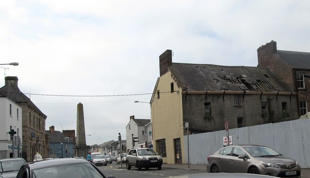
H6733 : Derelict building in Mill Street
taken 8 years ago, near to Monaghan, Co Monaghan, Ireland
![Creative Commons Licence [Some Rights Reserved]](https://s1.geograph.org.uk/img/somerights20.gif)
|
· Find out How to reuse this image ·
Share:
|
|||||
| Start a discussion on H6733 | Suggest an update to this image | Contact the contributor | |||
Loading map... (JavaScript required)
- Grid Square
- H6733, 421 images (more nearby
 )
)
- Photographer
- Eric Jones (find more nearby)
- Date Taken
- Saturday, 4 June, 2016 (more nearby)
- Submitted
- Sunday, 23 October, 2016
- Geographical Context
- Subject Location
-
Irish:
 H 671 337 [100m precision]
WGS84: 54:14.9053N 6:58.2553W - Camera Location
-
Irish: H 671 337
- View Direction
- Northwest (about 315 degrees)
This page has been viewed about 24 times.
View this location:
KML (Google Earth) ·
Google Maps ·
Bing Maps ·
Geograph Coverage Map ·
More Links for this image
·
Bing Maps ·
Geograph Coverage Map ·
More Links for this image