J3576 : The 'OceanPrincess' at Belfast
taken 7 years ago, near to Belfast, Co Antrim, Northern Ireland
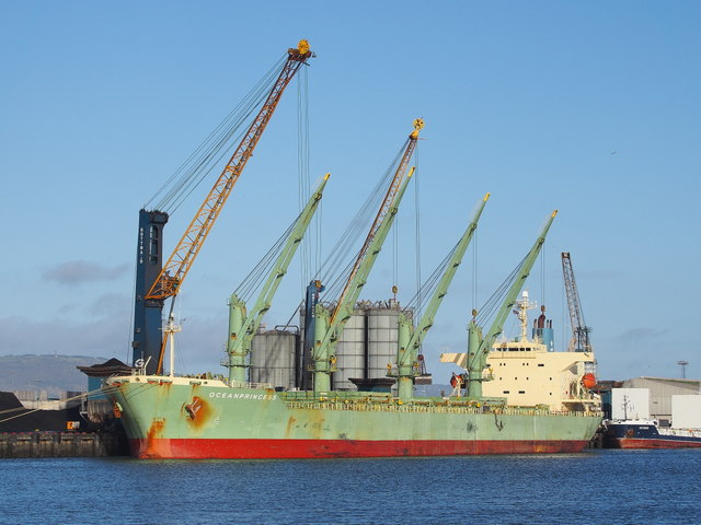
The 'OceanPrincess' at Belfast
195m (50,655 DWT) Liberian flagged bulk carrier 'OceanPrincess' Link discharging coal at Stormont Wharf, Belfast. See also J3576 : The "Oceanprincess", Belfast (January 2017).
Stormont Wharf, Belfast
Wharf at the Victoria Channel, Belfast docks. The wharf was constructed 1956-62 by Charles Brand & Son, to provide a total lineal quayage of 580 metres; this was further extended by an additional 250 metres which was completed in 2009. Stormont Wharf is now one of the longest deep water quays in Ireland.
![Creative Commons Licence [Some Rights Reserved]](https://s1.geograph.org.uk/img/somerights20.gif)
|
· Find out How to reuse this image ·
Share:
|
|||||
| Start a discussion on J3576 | Suggest an update to this image | Contact the contributor | |||
Loading map... (JavaScript required)
- Grid Square
- J3576, 974 images (more nearby
 )
)
- Photographer
- Rossographer (find more nearby)
- Date Taken
- Monday, 9 January, 2017 (more nearby)
- Submitted
- Sunday, 15 January, 2017
- Geographical Context
- Place (from Tags)
- Primary Subject of Photo
- Subject Location
-
Irish:
 J 352 760 [100m precision]
WGS84: 54:36.8673N 5:54.4518W - Camera Location
-
Irish: J 351 756
- View Direction
- NORTH (about 0 degrees)
Other Tags
Image Type (about):
cross grid
This page has been viewed about 154 times.
View this location:
KML (Google Earth) ·
Google Maps ·
Bing Maps ·
Geograph Coverage Map ·
More Links for this image