J3574 : Nos 213-223 Newtownards Road, Belfast (January 2017)
taken 7 years ago, near to Belfast, Co Antrim, Northern Ireland
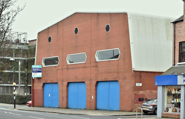
Nos 213-223 Newtownards Road, Belfast (January 2017)
Purpose-built for the sale of household goods and, in more recent times, a charity shop selling used furniture. Now vacant and to let. The agents description includes Extensive retail premises, which incorporates an extensive sales area on both the ground floor and first floors, together with a large number of private offices located at second floor level. This photograph appears as a matter of record only. I am not involved in the letting.
![Creative Commons Licence [Some Rights Reserved]](https://s1.geograph.org.uk/img/somerights20.gif)
|
· Find out How to reuse this image ·
Share:
|
|||||
| Start a discussion on J3574 | Suggest an update to this image | Contact the contributor | |||
Loading map... (JavaScript required)
- Grid Square
- J3574, 516 images (more nearby
 )
)
- Photographer
- Albert Bridge (find more nearby)
- Date Taken
- Tuesday, 31 January, 2017 (more nearby)
- Submitted
- Tuesday, 31 January, 2017
- Geographical Context
- Place (from Tags)
- Primary Subject of Photo
- Subject Location
-
Irish:
 J 357 743 [100m precision]
WGS84: 54:35.9380N 5:54.0259W - Camera Location
-
Irish: J 357 743
- View Direction
- Southeast (about 135 degrees)
Other Tags
This page has been viewed about 92 times.
View this location:
KML (Google Earth) ·
Google Maps ·
Bing Maps ·
Geograph Coverage Map ·
More Links for this image
·
Bing Maps ·
Geograph Coverage Map ·
More Links for this image