J3674 : Nos 58-60 Holywood Road, Belfast - February 2017(1)
taken 7 years ago, 3 km from Belfast, Co Antrim, Northern Ireland
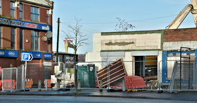
Nos 58-60 Holywood Road, Belfast - February 2017(1)
Demolition underway. No 58 was on the left.
Nos 58-60 Holywood Road, Belfast
A site, at the corner of Parkgate Avenue, which has the following planning permission (5 October 2016) LA04/2016/0631/F Demolition of retail units and erection of 2 storey retail building 58-80 Holywood Road Belfast BT4 1NT. The correct address might be 58-60 Holywood Road.
![Creative Commons Licence [Some Rights Reserved]](https://s1.geograph.org.uk/img/somerights20.gif)
|
· Find out How to reuse this image ·
Share:
|
|||||
| Start a discussion on J3674 | Suggest an update to this image | Contact the contributor | |||
Loading map... (JavaScript required)
- Grid Square
- J3674, 822 images (more nearby
 )
)
- Photographer
- Albert Bridge (find more nearby)
- Date Taken
- Saturday, 4 February, 2017 (more nearby)
- Submitted
- Saturday, 4 February, 2017
- Geographical Context
- Place (from Tags)
- Primary Subject of Photo
- Subject Location
-
Irish:
 J 366 743 [100m precision]
WGS84: 54:35.9075N 5:53.2011W - Camera Location
-
Irish: J 366 742
- View Direction
- West-northwest (about 292 degrees)
Other Tags
This page has been viewed about 82 times.
View this location:
KML (Google Earth) ·
Google Maps ·
Bing Maps ·
Geograph Coverage Map ·
More Links for this image
·
Bing Maps ·
Geograph Coverage Map ·
More Links for this image