V4177 : Church Ruins
taken 17 years ago, near to Knight's Town, Co Kerry, Ireland
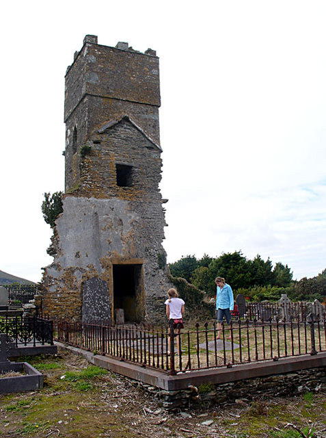
Church Ruins
Only the tower remains of the actual church building, standing in a small grave-yard.
![Creative Commons Licence [Some Rights Reserved]](https://s1.geograph.org.uk/img/somerights20.gif)
|
· Find out How to reuse this image ·
Share:
|
|||||
| Start a discussion on V4177 | Suggest an update to this image | Contact the contributor | |||
Loading map... (JavaScript required)
- Grid Square
- V4177, 9 images (more nearby
 )
)
- Photographer
- Linda Bailey (find more nearby)
- Date Taken
- Monday, 13 August, 2007 (more nearby)
- Submitted
- Sunday, 19 August, 2007
- Category
- Church (ruined) (more nearby)
- Subject Location
-
Irish:
 V 413 771 [100m precision]
WGS84: 51:55.4357N 10:18.4601W - Camera Location
-
Irish: V 413 771
- View Direction
- Northwest (about 315 degrees)
This page has been viewed about 229 times.
View this location:
KML (Google Earth) ·
Google Maps ·
Bing Maps ·
Geograph Coverage Map ·
More Links for this image
·
Bing Maps ·
Geograph Coverage Map ·
More Links for this image