2017
NZ5421 : Middlesbrough Road East, Grangetown
taken 7 years ago, near to Grangetown, Redcar And Cleveland, England
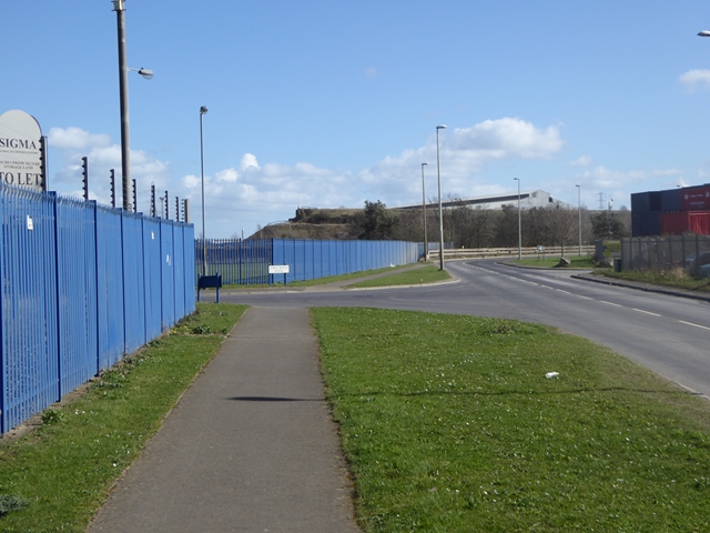
Middlesbrough Road East, Grangetown
Looking along a dreary stretch of road through an industrial area which is part of the diversion of the Teesdale Way and England Coast Path. The diversion was necessitated by the closure of a 2 km section of the Black Path since November 2015 during the decommissioning of the old Sahaviriya Steel Industries (SSI) site (see NZ5321 : The Black Path definitely closed east of South Bank station!). The diversion adds a further 2 km to the total length of the path.
 Map © Crown Copyright")
TIP: Click the map for more Large scale mapping
- Grid Square
- NZ5421, 28 images (more nearby 🔍)
- Photographer
- Oliver Dixon (more nearby)
- Date Taken
- Tuesday, 21 March, 2017 (more nearby)
- Submitted
- Wednesday, 22 March, 2017
- Subject Location
-
OSGB36:
 NZ 5422 2107 [10m precision]
WGS84: 54:34.9161N 1:9.7575W - Camera Location
-
OSGB36: NZ 54138 21073
- View Direction
- EAST (about 90 degrees)