2017
TR2655 : Twitham Hill
taken 7 years ago, near to Staple, Kent, England
This is 1 of 2 images, with title Twitham Hill in this square
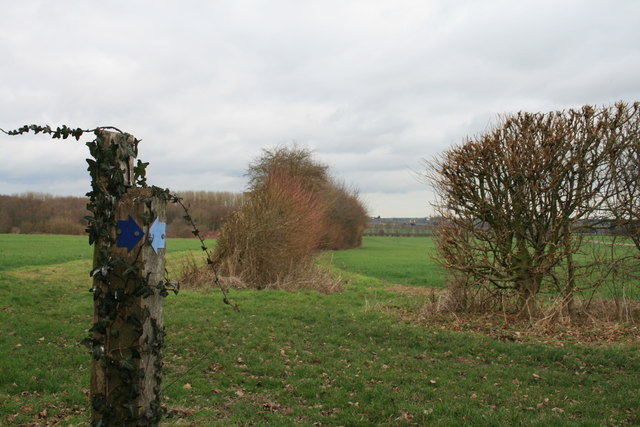
Twitham Hill
The waymark post signals the junction of public bridleways EE269A and EE28 adjacent to the pond in a former quarry on Twitham Hill. Ahead is the former course of Pettocks Lane towards Higher Twitham Farm (about 100m from the junction), of which no trace remains after a fire in 1875, and Staple Road.
 Map © Crown Copyright")
TIP: Click the map for more Large scale mapping
- Grid Square
- TR2655, 32 images (more nearby 🔍)
- Photographer
- Hugh Craddock (more nearby)
- Date Taken
- Tuesday, 21 February, 2017 (more nearby)
- Submitted
- Sunday, 9 April, 2017
- Subject Location
-
OSGB36:
 TR 2627 5595 [10m precision]
WGS84: 51:15.4673N 1:14.4907E - Camera Location
-
OSGB36: TR 2627 5592
- View Direction
- NORTH (about 0 degrees)