2017
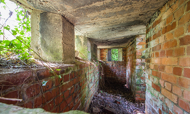
SU7308 : WWII Hampshire: environs of Havant & Emsworth - Comley Hill area pillbox no. 1 (8)
taken 7 years ago, near to Rowlands Castle, Hampshire, England
WWII Hampshire: environs of Havant & Emsworth - Comley Hill area pillbox no. 1 (8)
-
Pillbox (unclassified): DoB ID: S0012777
Interior end-to-end view through the southeast facing loophole showing the rectangular shape of the pillbox. The entrance on the north side is in the centre on the right.
SU7309 : WWII Hampshire: environs of Havant & Emsworth - Comley Hill area pillbox no. 2 (9)
 Map © Crown Copyright")
TIP: Click the map for more Large scale mapping
- Grid Square
- SU7308, 29 images (more nearby 🔍)
- Photographer
- Mike Searle (more nearby)
- Date Taken
- Friday, 7 April, 2017 (more nearby)
- Submitted
- Sunday, 9 April, 2017
- Subject Location
-
OSGB36:
 SU 7323 0894 [10m precision]
WGS84: 50:52.5197N 0:57.6337W - Camera Location
-
OSGB36: SU 7323 0894
- View Direction
- WEST (about 270 degrees)