2017
SY7481 : Defending Dorset: RAF Ringstead Chain Home Radar Station (8)
taken 7 years ago, near to Osmington Mills, Dorset, England
Defending Dorset: RAF Ringstead Chain Home Radar Station (8)
-
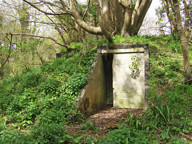
Chain Home radar station: DoB ID: e25089
Operational bunker No. 2. Moving south again towards the coast, a second bunker can be found in woodland to the west of the old medieval village of West Ringstead.
SY7481 : Defending Dorset: RAF Ringstead Chain Home Radar Station (9)
Chain Home radar station: DoB ID: e25089
Operational bunker No. 2. Moving south again towards the coast, a second bunker can be found in woodland to the west of the old medieval village of West Ringstead.
SY7481 : Defending Dorset: RAF Ringstead Chain Home Radar Station (9)
 Map © Crown Copyright")
TIP: Click the map for more Large scale mapping
- Grid Square
- SY7481, 54 images (more nearby 🔍)
- Photographer
- Mike Searle (more nearby)
- Date Taken
- Tuesday, 11 April, 2017 (more nearby)
- Submitted
- Saturday, 15 April, 2017
- Subject Location
-
OSGB36:
 SY 7458 8172 [10m precision]
WGS84: 50:38.0769N 2:21.6480W - Camera Location
-
OSGB36: SY 7458 8172